Depth conversion formula is a fundamental process in the field of geophysics and subsurface exploration, playing a critical role in accurately determining the true depth of geological formations. This process is particularly essential in the oil and gas industry, as well as in other fields like mining and groundwater management. This article explores what depth conversion entails, its importance, the methods used, and the challenges involved.
What is Depth Conversion?
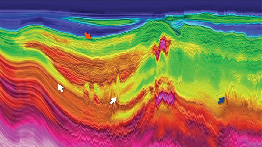
Depth conversion is the process of translating seismic reflection data, which is typically measured in time (seconds), into depth (meters or feet). Seismic data provides a time-based image of the subsurface structures, but for practical applications such as drilling, it’s crucial to know the actual depth of these structures. Depth conversion bridges this gap, enabling more precise subsurface mapping.
Importance of Depth Conversion
Accurate Resource Estimation: In the oil and gas industry, accurate depth conversion is vital for estimating the volume and location of hydrocarbon reservoirs. This accuracy ensures efficient resource extraction and minimizes the risk of drilling dry wells.
Safe Drilling Operations: Knowing the true depth of geological formations helps in planning safe drilling operations. It prevents drilling into unexpected formations, which could lead to hazards such as blowouts or equipment damage.
Cost Efficiency: Depth conversion reduces the uncertainty associated with drilling, leading to more efficient use of resources and lower operational costs. Accurate depth models help in optimizing well placement and reducing non-productive drilling time.
Environmental Protection: By providing precise information about subsurface structures, depth conversion aids in minimizing environmental impact. It ensures that drilling is conducted in a way that avoids sensitive areas and reduces the likelihood of unintended ecological damage.
Methods of Depth Conversion
Several methods can be employed for depth conversion, ranging from simple to complex, depending on the geological context and data availability:
Velocity Models: Velocity models are fundamental to depth conversion. These models represent how seismic wave velocities vary with depth and geological layers. Building an accurate velocity model is crucial, as errors in velocity estimation directly affect depth conversion accuracy.
Time-Depth Relationships: Establishing a relationship between seismic reflection time and depth is a common approach. This involves using well log data to correlate seismic times with known depths. Polynomial or linear functions are often used to fit these relationships.
Interval Velocity Method: This method involves calculating the interval velocity for each layer, which is then used to convert the seismic time to depth. This method requires high-quality seismic and well log data to ensure accuracy.
Geostatistical Methods: Advanced geostatistical techniques, such as kriging, can be used to interpolate velocity data and improve depth conversion accuracy. These methods consider spatial variability and can integrate multiple data sources.
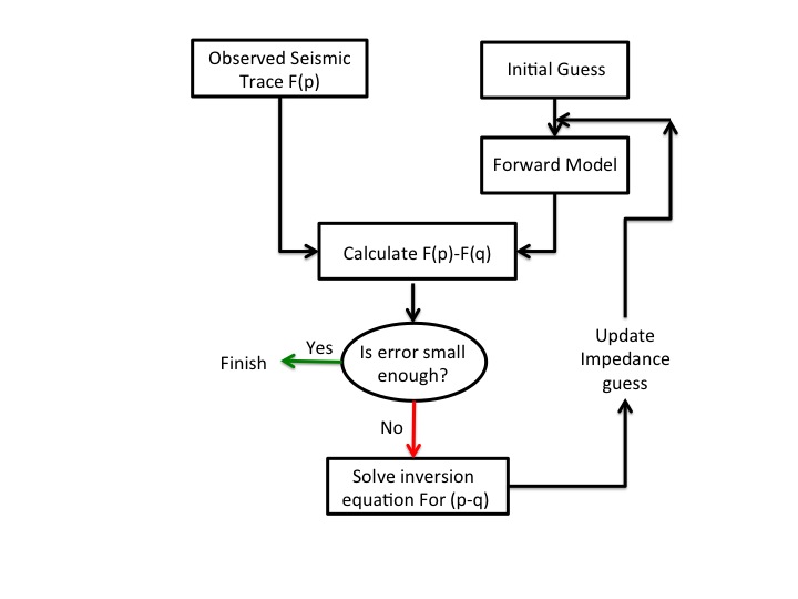
Tomographic Inversion: Tomographic inversion techniques use seismic data to build a detailed velocity model. These models are iteratively refined to match observed seismic data, providing high-resolution depth conversion results.
Challenges in Depth Conversion
While depth conversion is essential, it is not without challenges:
Velocity Uncertainty: Accurate velocity models are crucial for precise depth conversion. However, velocity data can be sparse or inconsistent, leading to uncertainties in the final depth model.
Complex Geology: In regions with complex geology, such as folded or faulted areas, depth conversion becomes more challenging. Advanced techniques and high-quality data are required to handle such complexities.
Data Quality: The quality of seismic and well log data significantly impacts depth conversion accuracy. Noise, resolution limits, and data gaps can introduce errors.
Integration of Multiple Data Sources: Combining data from various sources (e.g., seismic, well logs, and geological maps) is often necessary but can be technically challenging. Ensuring consistency and accuracy across different data sets is crucial.
Depth conversion is a critical process in subsurface exploration, transforming time-based seismic data into depth-based geological models. Its importance spans accurate resource estimation, safe drilling operations, cost efficiency, and environmental protection. Despite the challenges involved, advancements in velocity modeling, geostatistical methods, and tomographic inversion are continually improving the accuracy and reliability of depth conversion. For industries reliant on subsurface exploration, mastering depth conversion is key to successful and sustainable operations.


